 Sonde
SondeFollow the flight.
Find the sonde.
SondeFox brings radiosonde reception, live maps, saved flights, and field tools to Android, Mac, and iOS. Android and Mac can connect to supported USB SDRs; iOS uses a network rtl_tcp receiver. Public releases are being prepared separately for each platform.
Interactive preview of the main screens. Tap the bottom tabs.
Everything between the first peak and the recovered sonde
One app covers the whole chase: finding a signal, decoding it, navigating, the on-foot search, and reporting back to the community.
Band scan & decode
A live spectrum and waterfall straight from the SDR. Vaisala RS41 decodes fully: serial, GPS, and PTU with humidity from the sonde's own factory calibration. RS41 and DFM17 have the strongest validation evidence; DFM06/09, M10/M20, and iMet decode while field validation continues. From v0.14.14, that evidence status is separate from transmission eligibility: genuine radiosonde types with an exact SondeHub mapping may upload only after CRC, confirmed strict identity, GPS time/position, freshness, and plausibility gates, while SondeHub's server-side denylist decides protocol acceptance and roadmap decoders emit nothing.
2D chase map, offline
A MapLibre map with markers for you and the sonde, a breadcrumb trail, and the predicted landing point. Areas you browse are cached automatically, and Settings can prefetch every tile within 5 to 50 km, so the chase keeps rendering with zero coverage.
3D photorealistic map
The native Google Maps 3D SDK renders an online photorealistic scene with camera modes from Follow Sonde to Full Flight. It is a beta: when its network or runtime gates fail, the app returns to the complete 2D map.
Saved Flights
Follow a flight from SondeHub with no SDR attached. Enter the exact serial or payload callsign; the app syncs and backfills the flight and plays it back at up to 60×. Optional Auto-update is off until you enable it, then refreshes under the selected network policy at Android's 15-minute minimum. Your own decoded flights are saved too.
Auto-scan, multiple sondes
Finds sonde-shaped signals across the captured span and decodes up to six at once, each in its own channel. It is enabled on a fresh install and costs CPU and battery in proportion to the decode limit you pick.
Compass & Signal Hunt
A Find My-style arrow points at the sonde with live distance and bearing, from the phone compass or GPS course. For the last stretch on foot, the Signal Hunt heat-map paints signal strength onto the map and can switch on by itself as you close in.
SondeHub integration
SondeHub Live is available in current private builds as an explicitly activated, foreground-only network source. It can request active sondes, recent observations and recovery reports around the viewed map area and subscribe to selected flights. The selected network policy applies; reading does not enable telemetry uploads. Older builds differ. See the current privacy disclosure for the request, viewport and location details.
The full chase loop
-
Plug in and start
Connect an Airspy or RTL-SDR over USB OTG and tap Start Chase. The Spec tab shows the live spectrum and waterfall; type a frequency next to Tune and tap Go.
-
Lock & decode
Frames flow through error correction into the List tab: type, serial, frequency, altitude, climb rate, and signal quality, updating live. Fresh installs keep auto-scan on so several sondes can decode at once; you can disable it in Set.
-
Drive with map and compass
The map draws the flight track and, with landing prediction enabled, SondeHub's predicted touchdown. The compass arrow keeps distance and bearing in view.
-
Signal-hunt on foot
For the last few hundred meters, the Signal Hunt heat-map takes over. Walk the field, watch the hot spots build, and home in on the strongest samples.
-
Mark it recovered
Sonde in hand, tap Recovered to file a SondeHub recovery report so the next chaser knows this one is already off the board.
Straight off a test phone
Screenshots captured from beta build 0.9.24 on real hardware; current v0.14.0 controls may differ.
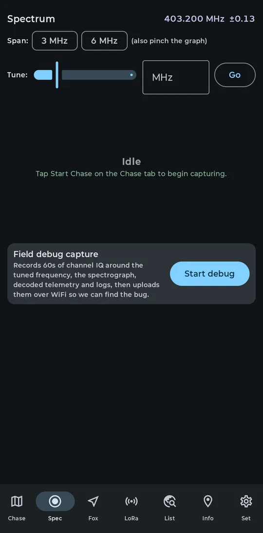
Spec tab tuned to 403.200 MHz, with the field debug capture card
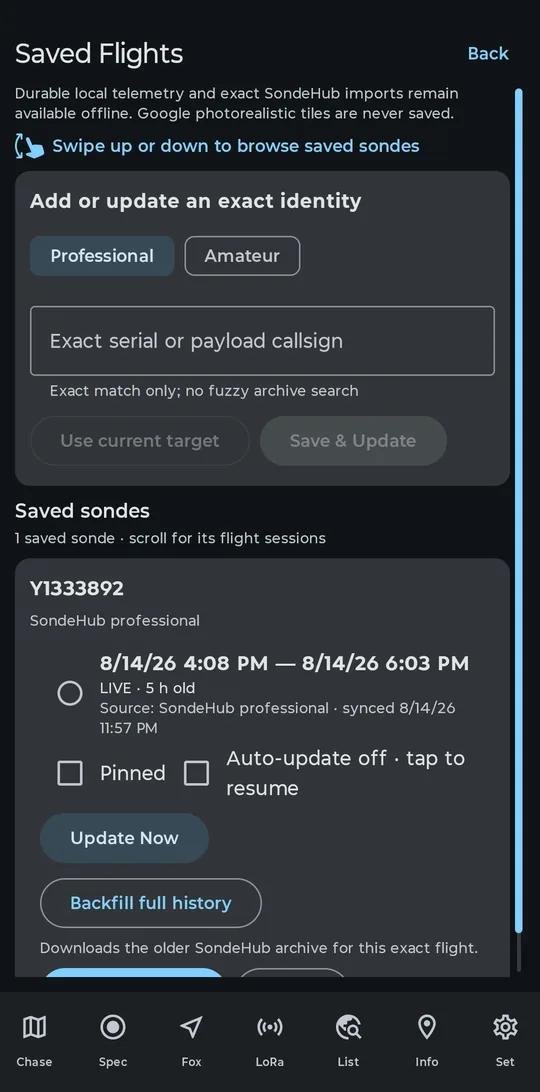
Saved Flights following a live SondeHub flight, no SDR attached
A whole chase rig in your pocket
The live demo at the top of this page is an interactive preview of the main screens; the full app has seven tabs.
RS41 first, the rest in progress
The Vaisala RS41 is the workhorse decoder, validated against real flights and SondeHub's own multi-station data, including calibrated humidity. DFM17 is validated too. DFM06/09, M10/M20 and iMet-4 decode but remain in field validation, while iMet-54, LMS6, Meisei, MRZ, and MTS01 are roadmap only and emit no telemetry. Those validation tiers remain honest evidence labels; from v0.14.14 they do not form a client-held upload rollout list. After explicit opt-in and a callsign, genuine radiosonde types with an exact SondeHub mapping may transmit only after CRC, confirmed strict identity, GPS time/position, freshness, and plausibility gates, and SondeHub's server-side denylist decides acceptance. Some things plainly do not work yet: tapping a spectrum peak does not tune (use the Tune field). SondeHub Live is currently available only in the separately installed SondeFox Test debug build; production v0.14.0 does not expose the Network Live source or authorize its REST/MQTT runtime. The debug preview must be activated explicitly and stops when the app leaves the foreground.
The per-type breakdown lives in decoder support. If that page reads like your kind of project, the beta program is open for testers.
Foxes wanted.
We're inviting a small group of sonde chasers with an Airspy or RTL-SDR and a launch site within driving range to help validate SondeFox in the field. Free to join.
Already testing? The tester area has build notes and test plans; it asks for the beta password.